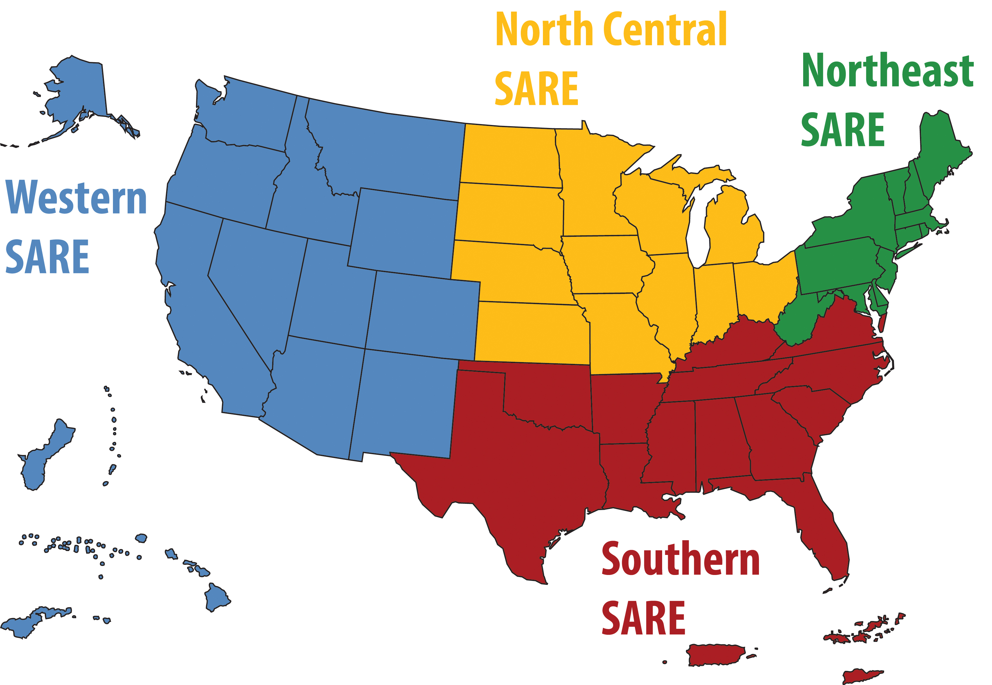
Visually, SARE's map is the best way for people to understand SARE is both its parts and the sum of its parts.
The map is available in a color palette we have used previously and in a black and white vector format that designers can customize.
To download a map, click on the file name. Download will automatically begin in your web browser.

| File | Format | Use |
| Note: These files must be used against white or light colored backgrounds. | ||
|
|
JPG | A high-resolution image that can be used for the web, presentations or in print. Image is in RGB color. |
|
|
EPS | For graphic design and high-quality printing on presses. |
For Designers
Use this Adobe Illustrator vector file to customize the SARE map.

For additional guidance, contact: